A Platform for Reality Capture, Spatial Intelligence, and Digital Twins
End-to-end geospatial solutions combining reality capture, AI-ready data, immersive visualization, and domain intelligence for the built and natural environment.
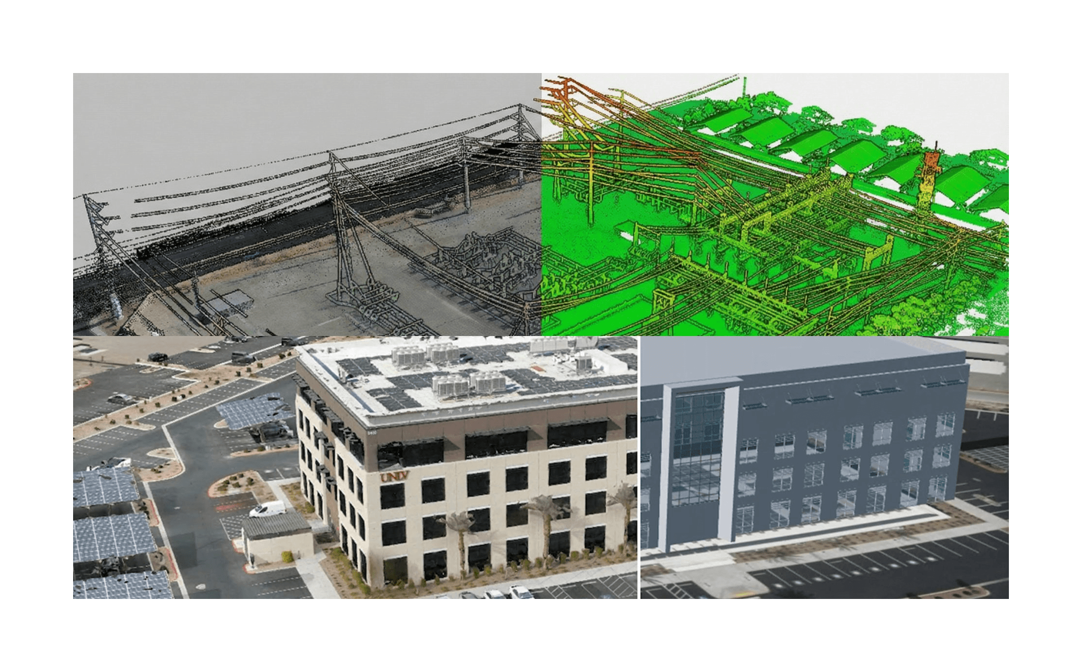
Bringing the Physical World to Life in 3D
AERO AI delivers advanced geospatial intelligence solutions for the built environment. Our mission is to help organizations visualize, analyze, and manage their assets and infrastructure through cutting-edge 3D technologies, high-quality data products, and immersive experiences. From architecture and construction to urban planning and utilities, we empower our clients to make better decisions and communicate more effectively.
The Core Pillars
Comprehensive geospatial intelligence for every project from platform to data to custom services.
Platform
Visualize, analyze, and simulate real-world environments using high-fidelity geospatial data across web and desktop experiences.
Solutions
Purpose-built solutions for AEC, infrastructure, utilities, AI training, research, and education, powered by real-world data.

Marketplace
Access curated aerial, terrestrial, and synthetic datasets - ready for AI training, analysis, and decision-making.
Solutions Built on Reality Capture and Spatial Intelligence
Purpose-built solutions for every industry and use case


Client Testimonials

Logan Swanson
Director of Acquisitions and Leasing at Badiee Development
AERO AI's quick response, professionalism, and attention to detail make them stand out. Their efficient, safe work consistently delivers great results, making them a top choice for aerial data solutions.

Tim Garrett
Landscape Architect at Avid Trails
AERO AI was responsive, on time, and met the quality standards we expected. We highly recommend their team.

Dan Stewart
Vice President of Development at Gardner Company
This is really cool stuff!

John Hardy
Chairman & Founder at The Hardy Group
Great job! The work was delivered on time and met our expectations. Highly recommend!
CLIENTS & PARTNERS


Start Your Journey with AERO AI
Explore our SiEGA platform, discover our data products, or get in touch to discuss a custom geospatial solution for your organization.